NASA’s “New NASA Views of Earth, From (S)PACE” is not simply a collection of striking Earth images. It is a short demonstration of how orbital observation is turning the planet’s surface, oceans, clouds, smoke, and biological activity into readable signals.
The focus is PACE — NASA’s Plankton, Aerosol, Cloud, ocean Ecosystem satellite. Launched in February 2024, PACE is designed to study Earth’s ocean and atmosphere by measuring cloud formation, particles and pollutants in the air, and microscopic marine life such as phytoplankton. NASA describes the mission as a way to better monitor ocean health, air quality, and climate change.
For SockoPower, the item belongs in Chain because it shows how satellite data can expose weak signals that matter to industrial systems. The article is not about rockets, astronauts, or deep-space exploration. It is about the observation layer that sits above maritime routes, coastal economies, fisheries, air quality, emergency response, and environmental risk.
One important detail is the difference between ordinary photography and PACE’s instrument view. NASA explains that while Artemis II photographs capture visible light, PACE’s Ocean Color Instrument observes Earth across a hyperspectral range that includes visible, ultraviolet, near-infrared, and shortwave infrared light. That broader view allows the satellite to detect patterns that are not simply “beautiful” but operationally meaningful.

The article gives several examples. PACE data tracked Saharan dust moving west across the Atlantic and wildfire smoke moving from the United States and Canada. In another case, PACE data followed smoke from fires in the greater Los Angeles area and helped distinguish particle characteristics in the atmosphere. These are environmental observations, but they are also signals for aviation, public health, emergency response, insurance, and logistics exposure.
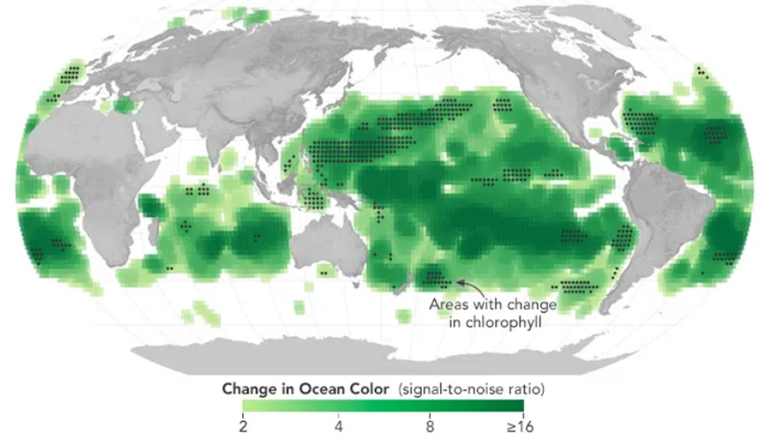
The ocean layer is just as important. NASA notes that PACE can detect harmful cyanobacteria blooms by identifying specific shades of blue, green, and red. It can also distinguish different types of phytoplankton, rather than merely detecting the presence of a bloom. That matters because some phytoplankton activity supports marine ecosystems, while other blooms can become harmful to people, animals, fisheries, tourism, and coastal businesses.
The most direct industrial clue in the article may be the section on ship tracks. NASA explains that bright streaks in some PACE ocean images can reveal the paths of ships below, because exhaust from ships changes the nature of clouds formed over the ocean. In other words, the satellite is not only seeing the atmosphere; it is also seeing traces of maritime activity through the cloud field.
This is the narrow strategic meaning of the item: PACE shows that Earth-observation satellites are becoming instruments for reading environmental and maritime conditions that surround the supply chain. The article should not be stretched into a broad claim that satellites now control supply chains. The more precise point is that orbital sensors are adding a new layer of early signal detection around the systems that supply chains depend on.
In Chain terms, PACE is a reminder that modern infrastructure is observed before it is disrupted. Dust, smoke, algal blooms, cloud changes, phytoplankton shifts, and ship tracks may look like science data. But in the right context, they can become warning signs for shipping, fisheries, coastal economies, air quality management, disaster response, and risk pricing.
The value of NASA’s PACE article is therefore modest but important. It does not announce a new industrial program. It shows the sensor logic behind one. As satellite instruments become more precise, the boundary between Earth science and industrial intelligence will continue to narrow.
Why It Matters
NASA’s PACE article matters because it shows how Earth-observation data can convert ocean color, smoke, dust, harmful algal blooms, cloud structure, and ship tracks into practical signals. For the Chain category, the key point is that satellite observation is becoming a supporting layer for maritime awareness, environmental monitoring, coastal risk, and supply chain resilience.
SockoPower Takeaway
PACE is not just producing new views of Earth. It is showing how environmental patterns can be read as supply chain signals. The strategic value lies in the sensor layer: the ability to detect changes in oceans, air, clouds, biological activity, and maritime traces before they become visible disruptions.
What to Watch Next
Watch how NASA and other public space agencies present Earth-observation data not only as climate science, but also as decision-support data.
Watch whether commercial satellite and analytics firms turn ocean color, aerosol, cloud, and ship-track observations into services for maritime, insurance, fisheries, and emergency-response markets.
Watch how governments incorporate satellite-derived environmental signals into national resilience and supply chain monitoring.
References
NASA Science, “New NASA Views of Earth, From (S)PACE,” April 21, 2026.
NASA Science, “PACE — Plankton, Aerosol, Cloud, ocean Ecosystem,” mission overview.
Socko/Ghost